
NASA WorldWind
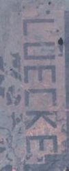
I was able to find this interesting image of a feature near Bastrop where a rancher cleared a bunch of trees to leave his name in huge letters, visible from space. The name is about 13,000′ long by 3,100′ high (2.5 miles long!). I’ve seen it a few times flying from Houston to Austin and it’s always a sight.
You can download WorldWind from this site: WorldWind. It’s a huge download and not suitable for dialups. You also need to have DirectX and the .NET Runtime environment from Microsoft (the latter is also a big download).